A partnership between the USFS and the Watershed Conservation Authority (WCA) commissioned BlueGreen to create a comprehensive plan for future improvements along the East Fork of the San Gabriel River, an area that is among the most popular Concentrated Use Areas in the ANF. Because the heavy use combined with the lack of facilities has resulted in the degradation of the project site, a solution required a careful balance between user interests, environmental protection and agency resources. After extensive site analysis and research, BlueGreen developed a comprehensive feasibility analysis, developed three alternatives, and worked with ANF and WCA to finalize a design plan for the East Fork that focuses on safety, concentrated access, enhancing habitat and providing design measures that would improve management outcomes.
Client: Watershed Conservation Authority (WCA),
The San Gabriel District of the Angeles National Forest
Location: East Fork, San Gabriel River
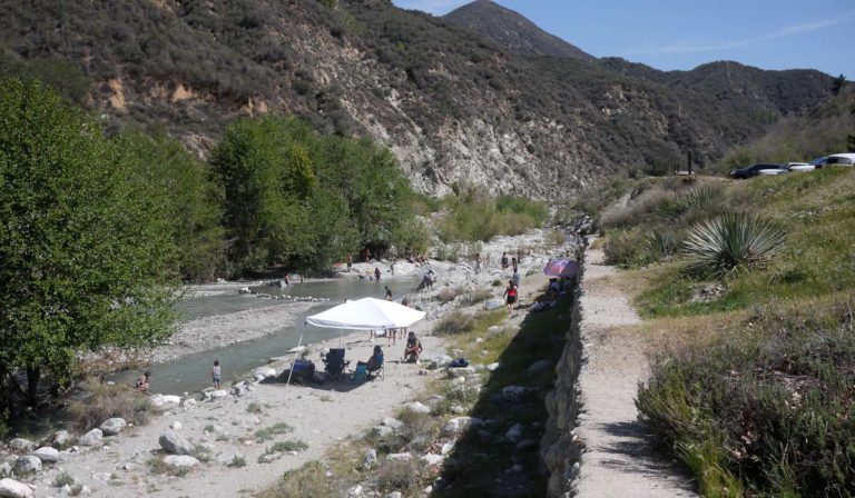
Visitors swim and picnic along the East Fork.
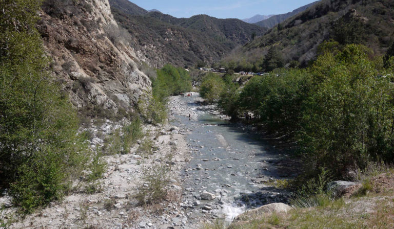
The East Fork of the San Gabriel River.
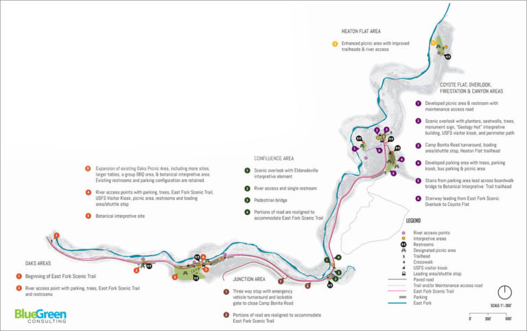
East Fork Summary Plan.
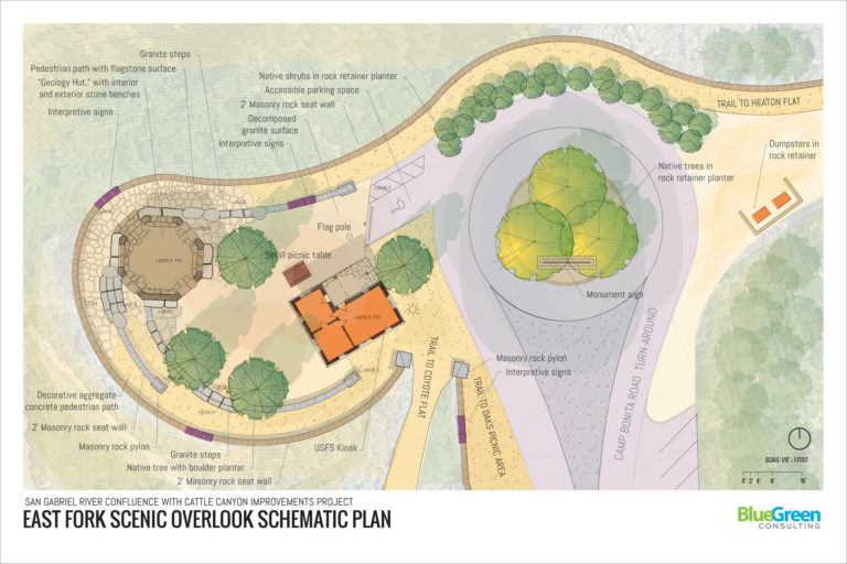
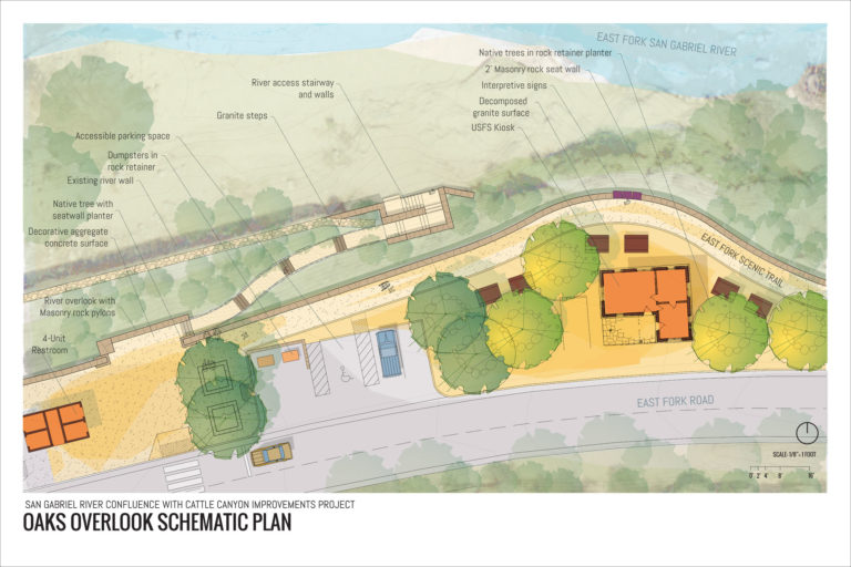
Conceptual design for the East Fork Overlook, Camp Bonita Road.
Illustrative Image of the Oaks Picnic Area and River Access Point.